GRASS GIS
7.8.5GRASS GIS: An accessible GIS application that lets you create maps, work with raster and vector objects, analyze geographical data and more
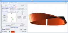
GRASS GIS is a robust Geographic Information System tool that enables you to analyze raster, vector, and point data, process images, perform geocoding, compare objects using the Map Swipe feature, as well as view and create maps.The application integrates with GDAL/OGR libraries which means it provides support for numerous raster and vector formats, allowing you to work with spatial data exported from other third-party tools but also save projects in various formats.
Should you have any trouble using this app, you can rely on a comprehensive set of tutorials, manuals and books that will teach you how to operate it.
Even if it’s packed with features, the interface of GRASS GIS is clean and practical, facilitating access to its functions.
Download Details
-
License:
Freeware
-
Platform:
Windows
- Publisher:
-
File size:
160.00 Mb
-
Updated:
Dec 28, 2020
-
User Rating:
0 / 5 (0 votes)
-
Editors' Review:
Not yet reviewed
-
Downloads:
2,641
Similar software
6 / 1,261
LPub3D 2.3.12.0.1356
Generate virtual LEGO constructions by using this application that provides you with a broad variety of useful, relevant features
71 / 2,686
Agisoft Metashape Professional 2.1.1 Build 17803
A great great app with a complete set of tools for creating georeferenced orthophotos.
21 / 3,331
CrystalMaker 11.0.2.300
A great that allows users to view high-resolution crystals and molecules to generate 3D virtual models.
20 / 2,068
pCon.planner 8.9.0.100
Great application for all types of users that want to create complex room layouts for their projects.
3 / 760