RTOPO
3.9RTOPO: A practical but feature-rich CAD application designed for surveying
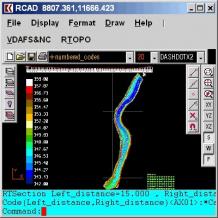
RTOPO is a reliable CAD application designed for surveying which enables you to do color-filled contour maps, triangulation, intersections, volume, sections and so on.The program enables you to process hundreds of thousands of triangles or points, even on computers with low-end hardware configurations.
RTOPO has its own CAD system called RCAD which enables you to load and draw a file of points without having the Number X Y Z Code format. Also, it is possible to interactively edit the XYZ files of points and triangulate the points on a convex hull or between an external contour and one or more interior contours.
On top of that, you can use the program to do cross sections and longitudinal profile, isolines, color-filed contour map, project multiple PLine entities over a triangulation, convert a triangulation to a regular grid of points, represent geological stratification caused by drilling and so much more!
Download Details
-
License:
Shareware ($93.75)
-
Platform:
Windows
- Publisher:
-
File size:
2.50 Mb
-
Updated:
Oct 04, 2023
-
User Rating:
0 / 5 (0 votes)
-
Editors' Review:
Not yet reviewed
-
Downloads:
1,799
Similar software
3DCombine 6.19.6
Efficient software that comes packed with many editing tools and to convert photos and videos to 3D.
4 / 1,018
Ultimaker Cura 5.7.0
Powerful software for controlling the printing process and managing 3D printers.
2 / 988