TNTatlas
2022 Build 20221130TNTatlas: Load and analyze geodata information stored in a variety of formats with some help from this handy program
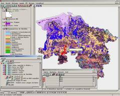
TNTatlas is an exceptionally useful software solution for absolutely anyone that would like to be able to load and analyze geodata. While this program is exceptionally well equipped for handling geospacial information and comes boasting a ton of handy features, the interface isn’t the most intuitive so you might have some difficulty with navigation unless you’re familiar with how this sort of program works.The main focus of this program is hierarchical atlases, but it’s equally good at dealing with other types of objects as well. It can even be used with a GPS device when you’re out and about if you’d like!
Features:
- Gives you the ability to load and analyze vectors or shapes with ease.
- Lets you load and analyze large maps and imagery in a variety of different formats (DWG, DXF, GeoTIFF, shapefiles, etc.).
- Various viewing options to ensure you get the best view possible every time.
- A variety of different stereo modes (anaglyph, interlaced lines or columns, split window, etc.).
- A handy toolbox full of instruments for selecting, making annotations, and more.
- Allows you to measure, sketch, and manage various regions from a loaded file.
- Equipped to be connected to a GPS device quickly and easily if you’d like.
- Customizable options for more advanced users.
- All of this and so much more for absolutely nothing.
Download Details
-
License:
Freeware
-
Platform:
Windows
- Publisher:
-
File size:
58.60 Mb
-
Updated:
Dec 07, 2022
-
User Rating:
4.0 / 5 (3 votes)
-
Editors' Review:
Not yet reviewed
-
Downloads:
6,822